About HILD
The Historic Indian Location Database (HILD) contains more than 1,000 mapped locations in Iowa, spanning nearly 500 years, from the earliest European trade contacts with natives to lands owned by tribes today. These locations illuminate some of the broader trends of population movement during the periods of Euro-American exploration and American settlement. The data are varied; they include archaeological sites as well as native accounts gleaned from digital archives such as local histories and newspapers.
Data that define the extent, duration, and location of historic-era native occupations of Iowa are scattered among hundreds of publications. Sources include early explorer maps, newspaper accounts, county histories, and old archaeology reports. Beginning in 2011, the University of Iowa Office of the State Archaeologist (OSA) began to compile these data into the HILD. Any location information that could be derived from these sources were GIS mapped as best as possible using historical maps as guides. Locations were limited to Iowa and out-of-state locations near Iowa.
Although location information from many sources are often vague–entries like "two miles north of town" are typical–they are precise enough for plotting on a statewide GIS map to show broader location trends.
Locations are labeled as to tribe, as best as can be determined, and coded in one of four ways:
- Habitation or Burial
- Friendly or Neutral Interaction, No Habitation
- Hostile Interaction, No Habitation
- Unknown
The HILD locations are also categorized by date of occupation as close as possible. These dates are categorized into one of five time periods:
- Pre-1825: Iowa was occupied by descendants of people affiliated with the archaeologically defined prehistoric Oneota, including Dakota, Ioway, Missouria, Omaha, and Otoe. Sauk and Meskwaki enter Iowa in the late 1700s. Trade goods and European traders enter Iowa, U.S. governmental control is minimal, and the U.S. Army is defeated by Indians at Fort Madison.
- 1825-1840: The Neutral Line of 1825 and Neutral Ground of 1832 were the first of many U.S.-imposed treaty boundaries, exacerbating tensions between Dakota and other tribes. In 1832 the Black Hawk uprising accelerated U.S. effort to move all tribes west of the Mississippi, pushing the Ho-Chunk and Potawatomi into Iowa.
- 1840-1850: U.S. settlement of Iowa began in earnest; all tribes were to be removed from the state; there were many encounters between settlers and Indians.
- 1850-1900: Many tribes returned to Iowa, including members of the Meskwaki, Potawatomi, and Ho-Chunk nations. The Meskwaki Settlement began by the early 1850s; Dakota uprisings caused panic among settlers in 1857 and 1863. Free-ranging Indians were commonly seen in rural Iowa, and mentioned mostly in association with peaceful interactions.
- 1900-Present. Gradual economic growth among tribes led to increased sovereignty. The Meskwaki Settlement grew, other tribes reacquired land in Iowa, including Ho-Chunk, Omaha, and Ponca. Social justice protests occurred in the 1970s and during recent anti-pipeline protest.
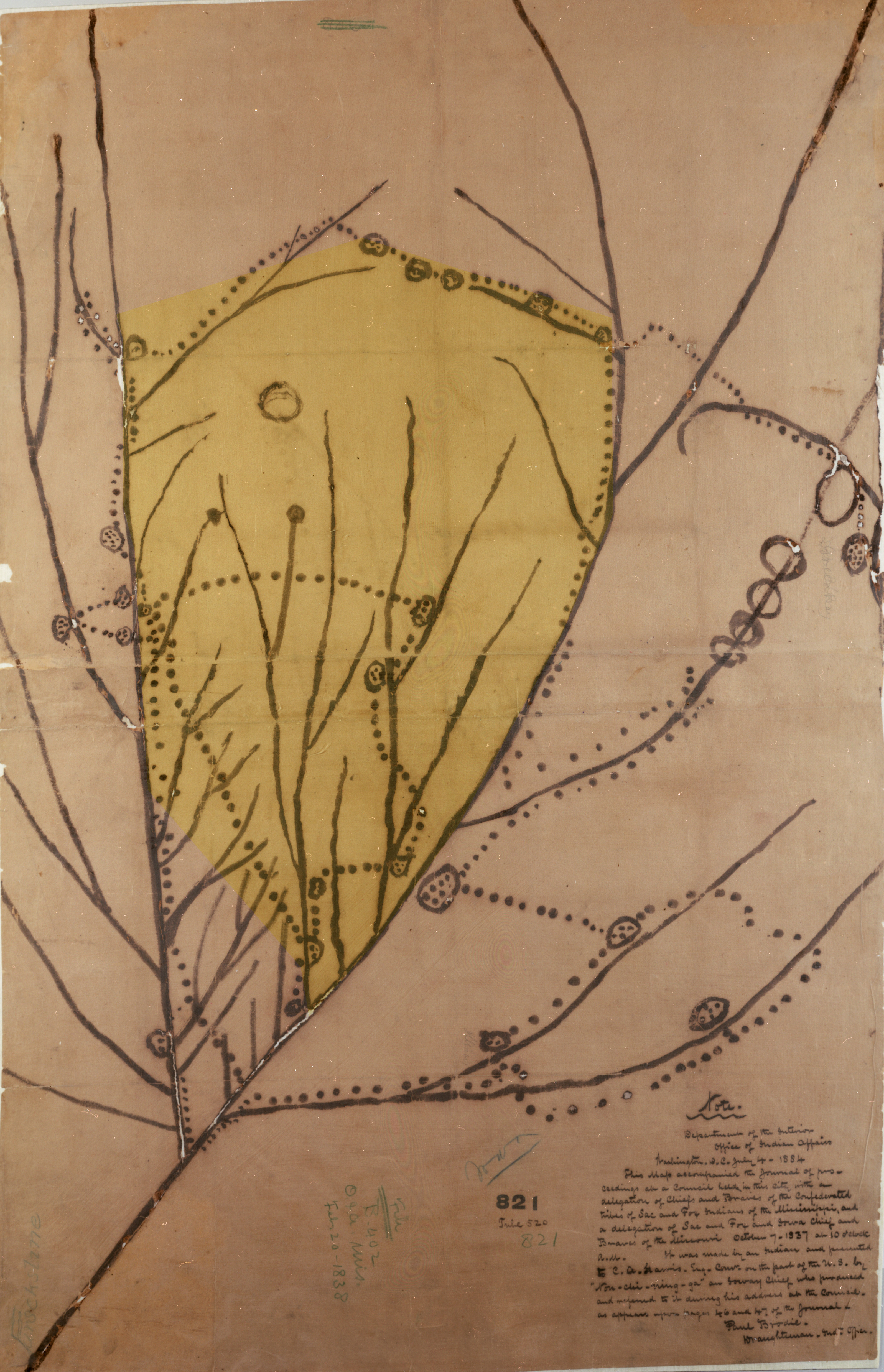
(click photo to enlarge)
The only surviving 1800s Indian-made map of Iowa is No Heart's 1837 map of Ioway villages. Approximate modern Iowa highlighted in yellow, between the Missouri and Mississippi rivers.
This map, unfortunately, is not useful for pinpointing village locations.
The exclusive use of European and American sources in this project leads to a lack of locations informed by indigenous memory, maps, or other kinds of information. Recent efforts at documenting Indian locations in Iowa by Indian nations have made fruitful contributions to historical understanding of Iowa's past, such as the Ioway, Meskwaki & Sauk History Project.
http://worldmap.harvard.edu/maps/6880